An old phone can serve as a bike computer for a GPS map or ride log if its location hardware and app support the task; Google’s Android location guide explains the GPS and sensor inputs available on Android phones (checked October 10, 2026). Set it up around one job first: record the ride, display directions, or both. Then secure it on the bars, allow the tracking app to use location in the background, and test the setup on a short local ride before relying on it farther from home.
A phone is a flexible screen and GPS recorder, but the result depends on the app and the phone’s condition. A route log is not the same as a dedicated cycling computer with the controls and accessory support described in a bike-computer manual. Keep your main phone accessible for calls or emergencies, and treat the old device as a useful display rather than the only way to find your way back.
If you also want the old device ready as a backup for a longer outing, see the site’s old-phone emergency backup checklist for contacts and offline preparation.
Pick the job before installing an app
Decide whether you need a live map, a ride record, or both. For directions, check that the app supports cycling routes. For a ride log, check that it can save a GPS track. If you want both jobs in one app, verify both features and its location permissions before choosing it. The label “bike computer” does not guarantee that an app supports cadence, heart-rate, or other external sensors.
If you mainly need a route recorder, open the app’s activity settings and look for a cycling activity and a way to save or export the recorded route. If you want turn prompts, confirm that the app can display a planned cycling route on your phone. Keep the setup lean: one app for the task, the map area you need, and no extra accounts or notifications unless you use them.
The site’s old-phone GPS setup covers map preparation for general navigation. For a bike ride, add the separate checks below: handlebar visibility, secure retention, background recording, and power in outdoor conditions.
Mount it where the screen stays out of the way
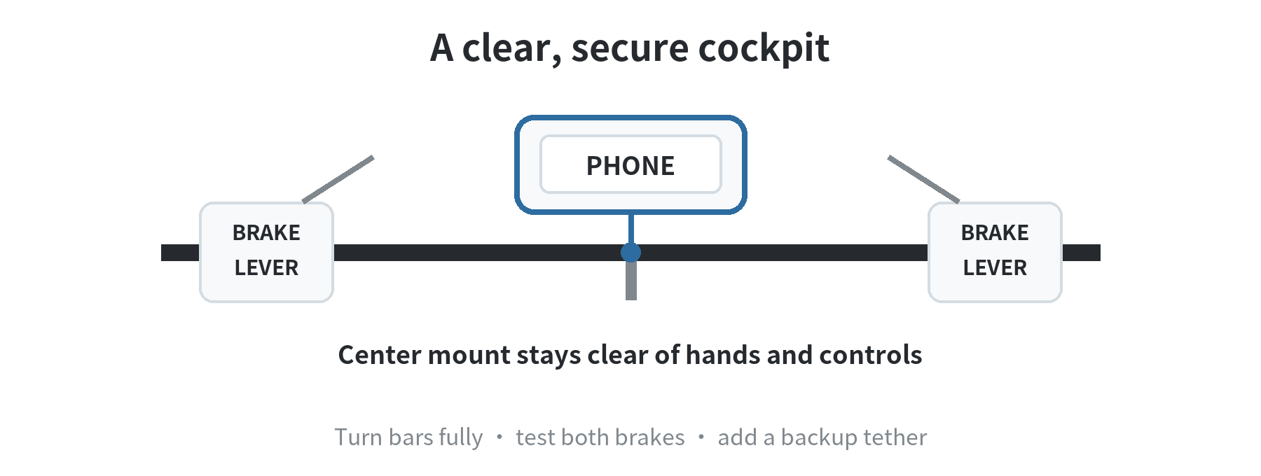
Use a handlebar mount made for the phone’s size and the bar diameter. Clamp it to a straight section that leaves the brake levers, shifters, cables, and your normal hand position clear. With the bike stationary, turn the bars fully each way and squeeze both brakes. The phone should not hit the frame, your hands, or a cable. You should be able to glance at the display without looking down for long.
Lock the mount as its instructions specify, then tug the phone in several directions before riding. A separate tether gives you a backup if the phone releases from the holder; Garmin’s bike-computer manual shows an optional tether secured from the device to the handlebar (checked October 10, 2026). Do not let a charging cable hang near a wheel or steering joint. If the phone needs power, route the cable so it cannot snag and stop using it if the connection shifts while steering.
Vibration deserves a measured approach. Apple Support’s vibration guidance says prolonged, high-amplitude vibration can affect the camera stabilization and autofocus systems in some iPhones; its examples focus on high-powered motorcycles (checked October 10, 2026). That guidance does not quantify exposure on a bicycle. If vibration is a concern, consider a mount with vibration damping; on rough trails, carrying the phone in a pocket and using a separate display is another option.
Prepare the phone for GPS recording
Charge the phone, install system updates over Wi-Fi, and remove apps you do not need for the ride. Check that location is enabled and give the cycling app the location permission it requires while the screen is off. Google’s Android location guide says location may use GPS, wireless signals, and device sensors; with Location Accuracy turned off, GPS and sensors can still determine location when available, though app availability or accuracy may change (checked October 10, 2026). A cellular plan is not the same thing as GPS access.
Before you leave Wi-Fi, open the app and save any route or map data it supports offline. Then switch off mobile data or use airplane mode with location re-enabled, and check that the app still finds your position and records a track. Menu names vary by phone and software version, so follow the current settings shown on your device rather than an old screenshot.
Offline maps and offline directions are different features. Google Maps Help says you can save map areas to the device, but bicycling directions are unavailable when offline (checked October 10, 2026). If you need turn-by-turn cycling guidance without a connection, choose an app that specifically supports offline bike routes and test the planned route before the ride.
Make the battery last without hiding a heat problem
For a ride recorder, start with a full charge and test with the screen dimmed or off after the app has begun recording. Background behavior depends on the phone and app, so verify that the route continues to record with the display asleep. If you need a bright map, test the battery under that screen setting and the app you plan to use before extending the ride.
Heat can interrupt the session. Apple lists an ambient operating range of 32–95°F (0–35°C) for iPhone and iPad, while Google lists the same range for Pixel 6 phones; both warn that temperature can affect operation (checked October 10, 2026). Google’s Pixel heat guidance also says extended navigation use can heat a Pixel and recommends keeping it out of direct sun. Apple’s guide separately warns about GPS tracking or navigation in hot conditions or direct sunlight. Do not wrap the phone in an insulating cover to block glare. If it shows a temperature warning or becomes unusually hot, stop, unplug any power cable, move it out of the sun, and let it cool before continuing.
Do not judge the setup by a battery percentage from one ride. Use a short test that resembles your planned ride: same app, screen setting, map use, and charging arrangement. If the phone stops recording, check its battery-saving rules and app permissions while you are back at home. A compact power bank in a bag can be a backup, but keep the phone itself ventilated and follow its charging instructions.
Run a short test before trusting the route log
Start outdoors with a clear view of the sky. Wait for the app to show a usable position, begin the recording, lock the screen, and ride a familiar loop. At home, confirm that the saved activity includes a continuous route and the start and finish you expected. If you planned offline navigation, repeat the check without mobile data and confirm the map covers the full route.
For a clean test, leave the phone in the mount through a few turns and ordinary pavement, then inspect the holder and tether before extending the ride. Stop if the phone shifts, the display blocks a control, the app pauses when locked, or heat warnings appear. This gives you a specific issue to fix—mount fit, permission, map coverage, or battery behavior—without trying to diagnose it while moving.
After each ride, save or export the activity if the app offers that option, and check where it stores location history. The Federal Trade Commission notes that precise location data can reveal where a person lives or works (checked October 10, 2026). Set route sharing to private unless you intend to publish a track. A spare phone works best when the job stays simple: secure display, location access, tested recording, and a backup plan for power or navigation.
FAQ
Can an old phone pair with a cadence or heart-rate sensor?
Only when the phone, sensor, and cycling app support the same connection method. Check the sensor instructions and the app’s supported-device list before relying on live sensor readings.
Can I open a recorded bike route on a computer after the ride?
That depends on the recording app. Look for its route export or share option and check which file types a mapping or training program can open before you choose the app.
What if a cycling app no longer installs on an older phone?
Check the app listing or developer support for the operating-system versions it currently supports. If the phone cannot run a supported release, use another compatible app rather than installing an old copy from an unknown download site.
How can I save battery if the map must stay visible?
Google recommends reducing display brightness as one way to keep a Pixel from getting too hot (checked October 10, 2026). Download map data over Wi-Fi, and carry a separate power source if your test ride shows the battery is not enough. Keep the phone ventilated and stop charging it if a temperature warning appears.
Last updated: 2026-10